Subject: United States & Mexico
Period: 1850 (circa)
Publication: Illustrated Atlas and Modern History of the World
Color: Hand Color
Size:
13 x 10 inches
33 x 25.4 cm
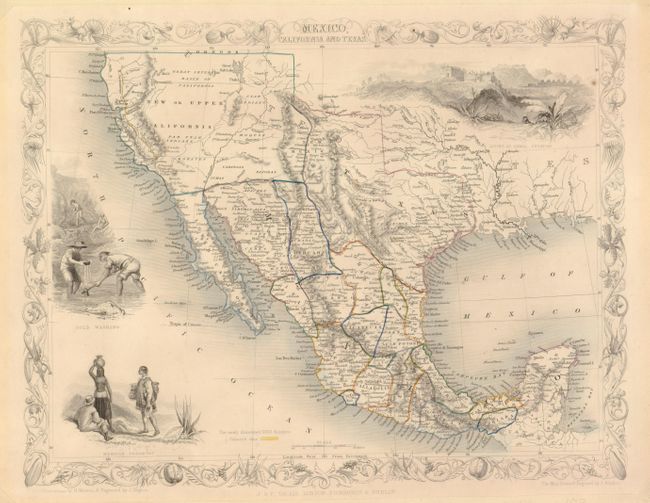
This is the second, and most desirable, state of this fine steel engraved map that was issued during a time of great transition in the region. After gold was discovered in California, the plate was re-engraved to include a vignette of gold panning and to locate the gold regions of California which are delineated through hand coloring. Texas is shown with its original state borders that include much of present-day New Mexico and extends into Colorado. Two other vignettes show Mexican peasantry and the ancient Mayan ruins at Uxmal. The very decorative border incorporates native plants of the region. Map drawn and engraved by John Rapkin, vignettes drawn by H. Warren and engraved by J. Rogers.
References: Wheat (TMW) #694.
Condition: B+
The map image and coloring are fine with no flaws. In the past the map was paper backed and framed. The tips of the corners are trimmed in the blank margins and a mat burn surrounds the map outside of the image. Margins are more generous than often seen on this map.