Subject: United States & Mexico, Texas
Period: 1842 (dated)
Publication:
Color: Black & White
Size:
9.5 x 7.5 inches
24.1 x 19.1 cm
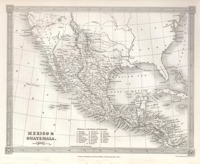
The crisply engraved map features the Independent Republic of Texas with S. Antonio de Bexar indicated as the capital and locates Victoria, Nacogdoches, Harrisburg, Gaurdia Barca and several more settlements. Mexico controls the entire southwest and California as Upper or New California. The Baja is Lower or Old California. The Great Salt Lake is Youta or Great Salt L. The Great Basin shows pre-Fremont information with several detached rivers. New Albion is in the vicinity of Cape Mendocino. Detail including watershed, Indian Tribes, scores of towns and villages increases in Mexico, south. The map extends to include Florida and most of the East coast, but all interior detail stops at the Mississippi except to name New York, Philadelphia and New Orleans. Table at bottom keys to 25 States of Guatemala.
References:
Condition: A+
Very nice example.