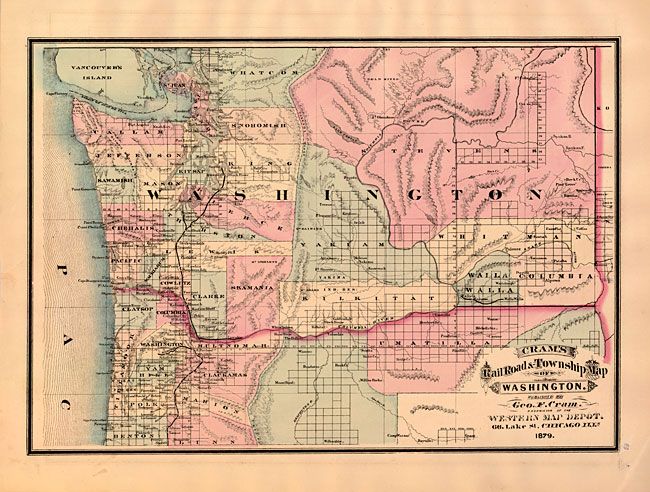
Subject: Washington
Period: 1879 (dated)
Publication: Cram's Standard American Atlas of the United States
Color: Hand Color
Size:
19.6 x 13.7 inches
49.8 x 34.8 cm
This scarce map is from the 1st Edition of Cram's most celebrated atlas. It covers all of Washington with the northern portion of Oregon to below Corvallis and Albany. Tevens county occupies the entire northeastern part of Washington. The map focuses on railways which are in short supply here. A short rail runs between Wallula and Walla Walla, others span Vancouver to Seattle, Portland to Albany and an apparently unconnected rail runs from Portland west a short distance to Wapto. The map locates many forts, early towns, rivers and depicts topography in hachure. The imprint is Cram's Western Map Depot, 66 Lake St. Chicago, Ills. There was a close relationship between the Cram and Watson firms, who also published from this address. This Lake Street address was the home to Cram's publishing company between 1873 and 1879, thereafter moving to Wabash Avenue. An equally fascinating Cram's Railroad & Township Map of Oregon is on the verso.
References: Chicago Map Makers: "George F. Cram and the American Perception of Space" Gerald A. Danzer
Condition: A+
Very fine impression and hand coloring with full margins. The strong impression has left a trace of offsetting below lower neatline, still fine.