Subject: West Virginia
Period: 1867 (dated)
Publication: Military Maps … Armies of the Potomac and James
Color: Black & White
Size:
21.5 x 32 inches
54.6 x 81.3 cm
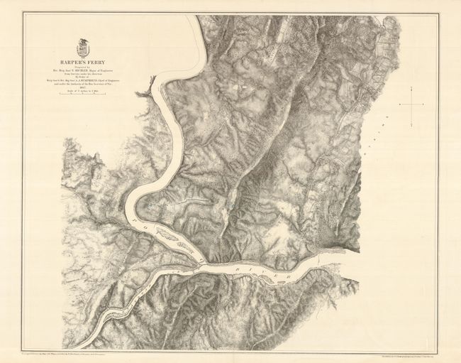
Civil War map detailing the vicinity of the important Harper's Ferry. This highly detailed map is from surveys under the direction of Bvt. Brig. Gen. N. Michler, Major of Engineers by Order of Brig. Genl. & Bvt. Maj. Gen. A.A. Humphreys, Chief of Engineers. In area locates Bolivar, the Charlestown Pike with Tollgate noted two miles west of Harper's Ferry, Waldro's School House, Stone Fort, and numerous houses and farms with owner's name, mostly along the road and railroad to Brownsville. Map shows remarkable detail to include common roads, railroads, towns, vegetation, and relief by hachure. Lithographed by Julius Bien.
References: Stephenson (CW) Maps #558.2
Condition: A+
Fine, dark impression and full, wide margins.