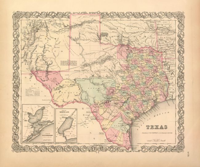
Subject: Texas
Period: 1855 (dated)
Publication: Atlas of the World
Color: Hand Color
Size:
15.75 x 12.75 inches
40 x 32.4 cm
This is Colton's only map of Texas published on a single sheet. The handsome map has extensive detail throughout the settled part of the state. County development ends with Cook, Coryelle, etc. The western third is comprised of the large unsettled areas of Presidio, El Paso, Bexar and the Staked Plain. It locates railroads, forts, post offices, roads, springs, and topographical detail. With two insets: Plan of Galveston Bay from the U.S. Coast Survey, and Plan of Sabine Lake. All contained in Colton's decorative scroll border. Dated 1855 but county development is current to about 1854, making this the uncommon first edition. Tarrant counties appears, but not the 1855 addition of Parker to Tarrant's west.
References:
Condition: A
Map images is fine but there is some toning in the very wide margins and a few tiny tears at edge.