Subject: Pennsylvania
Period: 1795 (circa)
Publication:
Color: Hand Color
Size:
18 x 11.4 inches
45.7 x 29 cm
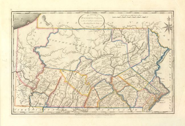
This important map of Pennsylvania was based on Reading Howell's large map of 1792. It is the first detailed map to show the state's proper boundaries. Nicely engraved to show topography, county boundaries, roads, and towns. The Erie Triangle is included in Pennsylvania. Longitude is given from both London and Philadelphia. The map was engraved by James Smither and published in one of Mathew Carey's important early American publications: Carey's General Atlas, or The General Atlas for Carey's Edition of Guthries Geography Improved..
Mathew Carey was a seminal figure in early American publishing; establishing the first publishing firm to specialize in cartography and issuing the first atlas devoted exclusively to American maps. He set up an elaborate cottage system of craftsmen for compiling, engraving, printing, and coloring maps. This practice was emulated by later American cartographic publishers such as John Melish and Henry S. Tanner. The American Atlas concept was also adopted by other publishers in both the United States and Europe.
References: Ristow, pp.151-153; Wheat & Brun #442.
Condition: A+
A fine example with wide margins.