Subject: Oklahoma
Period: 1898 (dated)
Publication:
Color: Printed Color
Size:
22 x 14.3 inches
55.9 x 36.3 cm
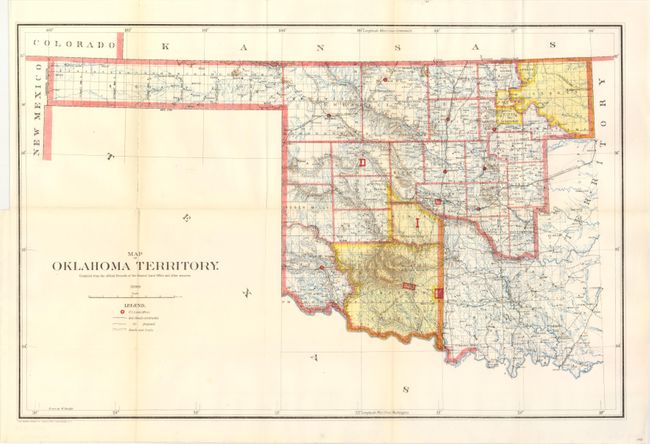
A good map of the western part of the present state of Oklahoma that also includes a portion of the steadily shrinking Indian Territory. The lands of the Kiowa, Comanche and Apache are depicted in yellow at the bottom; at the top, tribal holdings of the Osage, Ponca, Kansas, Otoe and Missouri are also colored yellow. Army posts are marked in red -- Ft. Sill, Ft. Reno and the Wood Res. Railroads, public roads and trails are identified by symbols shown in the legend. Land Offices are located at Woodward, Alva, Enid, Perry, Guthrie, Kingfisher, Ft. Reno, Oklahoma City, and Mangum. Lawton appears as a Land Office in 1901.
References:
Condition: B+
Originally issued folding, this map is pressed and backed with archival tissue on verso. The map features full margins and bright color. A trace of toning along one fold.