Subject: Oklahoma
Period: 1844 (dated)
Publication:
Color: Black & White
Size:
7.3 x 4.5 inches
18.5 x 11.4 cm
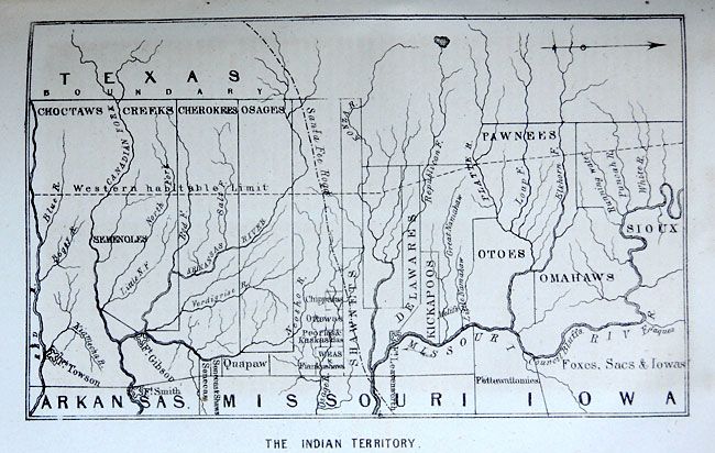
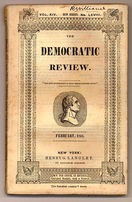
This most uncommon map shows the divisions of lands owned by the various tribes. Covering the area of today's Okalahoma and Kansas, the map locates the lands of the Choctaw, Creek, Cherokee, Osage, Pawnee, Sioux and more. Also shown is the Santa Fe Road, Fort Leavenworth, Fort Smith and the "Western Habitable Limit". The map is bound into the original The United States Magazine and Democratic Review, Vol. XIV, No. LXVIII, February 1844, at page 172. Contains text relating to U.S. Government polices toward Indians. 8vo, 220pp. The decorative front cover contains columns and a U.S. eagle at each corner, the quote "The Best Government is that which Governs Least" and a portrait of Thomas Jefferson are at center. The front piece "Clevengers Indian Chief" faces the contents page with a legal errata page added describing the settlement of the business.
References:
Condition: A
The map is fine. A little foxing to end pages and old ink notation at top of cover.