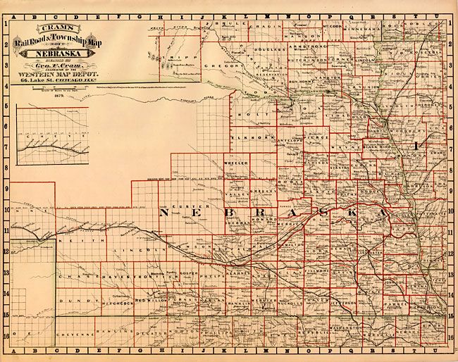
Subject: Nebraska
Period: 1879 (dated)
Publication: Cram's Standard American Atlas of the United States
Color: Hand Color
Size:
21.4 x 16.2 inches
54.4 x 41.1 cm
This scarce map is from the first edition of Cram's most celebrated atlas. Cram included as much information as possible on his maps, but he had to leave the northwestern portion of Nebraska above Custer County completely blank as no surveys had been completed and no settlements established. It is filled with high detail in the rest of the states with hundreds of place names, all counties and railroads delineated and named. Embellished with a Victorian-style title. The imprint is Cram's Western Map Depot, 66 Lake St. Chicago, Ills. There was a close relationship between the Cram and Watson firms, who also published from this address. This Lake Street address was the home to Cram's publishing company between 1873 and 1879, thereafter moving to Wabash Avenue.
References: Chicago Map Makers: "George F. Cram and the American Perception of Space" Gerald A. Danzer
Condition: A+