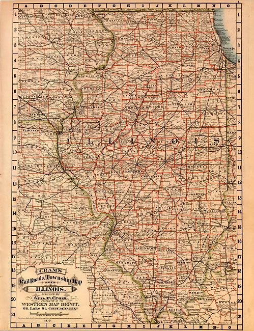
Subject: Illinois
Period: 1879 (dated)
Publication: Cram's Standard American Atlas of the United States
Color: Hand Color
Size:
15.3 x 21.5 inches
38.9 x 54.6 cm
This scarce map is from the first edition of Cram's early and most celebrated atlas. It is a great example of Cram's desire to impart as much information as possible in his maps. It is highly detailed with hundreds of place names. The railway system is well developed and the network fills much of the state. Includes much of eastern Iowa and Missouri south to the Cape Girardeau area. Embellished with a Victorian-style title. The imprint is Cram's Western Map Depot, 66 Lake St. Chicago, Ills. There was a close relationship between the Cram and Watson firms, who also published from this address. This Lake Street address was the home to Cram's publishing company between 1873 and 1879, thereafter moving to Wabash Avenue.
References: Chicago Map Makers: "George F. Cram and the American Perception of Space" Gerald A. Danzer
Condition: A+