Catalog Archive
Auction 131, Lot 308

"Carte Reduite des Cotes et de l'Interieur de la Presqu'ile de la Floride, avec le Detroit de Cette Presqu'ile et le Canal de Bahama", Sartine
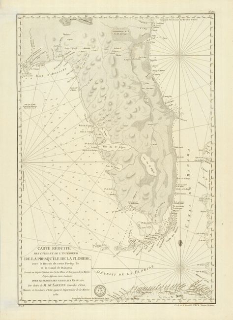
Subject: Florida

Period: 1780 (dated)

Publication:

Color: Black & White

Size:
15.5 x 22.8 inches
39.4 x 57.9 cm
Download High Resolution Image
(or just click on image to launch the Zoom viewer)

This is a superb map of the Florida Peninsula, covering from St. Mary's River to St. Joseph Bay. It provides excellent detail of the bays, inlets, rocks, shoals, islands and keys along the coast with soundings, towns, forts, and Indian villages. It also includes the Bahama Channel and some of the islands in the Bahamas, the Straits of Florida, and the northern coast of Cuba. Antoine Sartine was the French Minister of Marine and this chart was intended for use by the French Navy during the American Revolutionary War. The seal of the Depot de Marine is at bottom center with Prix Trois Francs below the neatline at right.

References: Seller & Van Ee #1621.

Condition: A+

Estimate: $2,500 - $3,000

Sold for: $2,500

Closed on 3/17/2010

Archived