Subject: Pensacola, Florida
Period: 1760 (circa)
Publication:
Color: Black & White
Size:
10.4 x 7.2 inches
26.4 x 18.3 cm
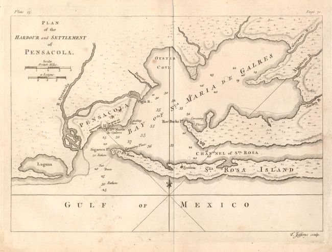
This uncommon map is very similar to Bellin's Plan de la Baye de Pensacola dans la Floride except for being rotated 90° to orient north to the top of the map and the addition of small icons indicating foliage in the interior. It is also virtually identical to the inset in Gibson's A Map of the New Governments, of East & West Florida which appeared in the Gentleman's Magazine (Ref: Jolly GENT-171) November 1863. This copperplate engraved map shows the bay with the tiny village of Pensacola protected by Fort Sta. Maria de Galres and Ft. Sta. Rosa across the bay. This map was engraved during the second Spanish period of occupation 1722 - 1763. Soundings and a bit of topographical detail on the coast are all that is shown. The simple rhumb lines with a fleur-de-lys are balanced by the text based titling at upper left. At lower right "T. Jefferys sculp." Blank verso. We find no references or past pricing for this scarce issue and only locate one example in the University of Miami Library.
References:
Condition: B+
A few spots and small area of light water stain at lower right corner in blank margin.