Subject: South Dakota
Period: 1904 (dated)
Publication:
Color: Black & White
Size:
26 x 22.5 inches
66 x 57.2 cm
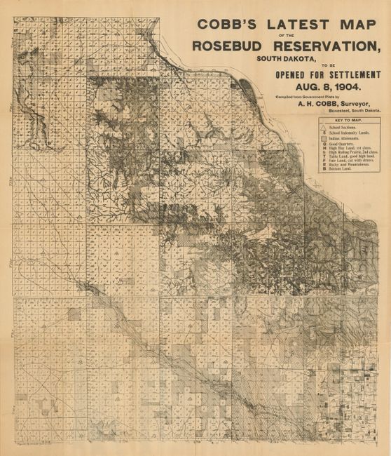
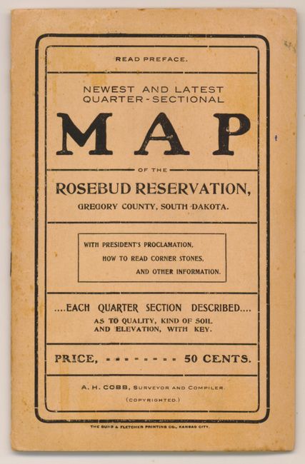
This scarce ephemeral pocket map delineates that portion of the Rosebud Indian Reservation being offered to homesteaders. The quarter-section map covers most of Gregory County with the key identifing School Sections, School Indemnity Lands, Indian Allotments, and type of land including Good Quarters, High Hay Land 1st Class, Table Land, "Fair Land, Cut with draws" and several more. This broadside-style map folds into soft covers with the original price of 50 cents noted. The eight page booklet details the proclamation of sale and who qualifies to purchase and the price per acre. We find no references or past sales records. Drawn, surveyed and published by A.H. Cobb, Surveyor, Bonesteel, South Dakota. Printed by Burd & Fletcher Printing Co., Kansas City. A very nice example of a rare land sale map.
References:
Condition: A
Map is near fine but with archival tape on some fold intersections on verso and one small split at upper fold. Covers are also near fine.