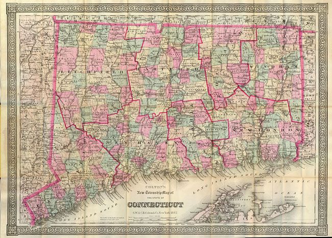
Subject: Connecticut
Period: 1882 (dated)
Publication:
Color: Printed Color
Size:
24.3 x 17.6 inches
61.7 x 44.7 cm
This great folding pocket map is dated 1882 with the imprint dated 1879. The map is large format and completely different from their atlas map. Surrounded by a large and graphic border the map contains very detailed information on roads, towns and villages, rivers, railroads and topography. Printed on fine banknote quality paper. Folds into 4" x 6" embossed and gilt brown boards. Inside original paper label advertises the Colton brother's other maps, atlases and "Maps for Railroad and Mining Reports."
References:
Condition: A
The map is near fine with just a hint of toning on lower horizontal fold. Lovely original hand coloring, crisp impression and full margins. The cover is very good with just slight bumping to corners. The inside pasted paper is separate at center.