Subject: California
Period: 1857 (dated)
Publication: Sen Ex Doc No. 14 35th Congress 2nd Sess.
Color: Black & White
Size:
30 x 36 inches
76.2 x 91.4 cm
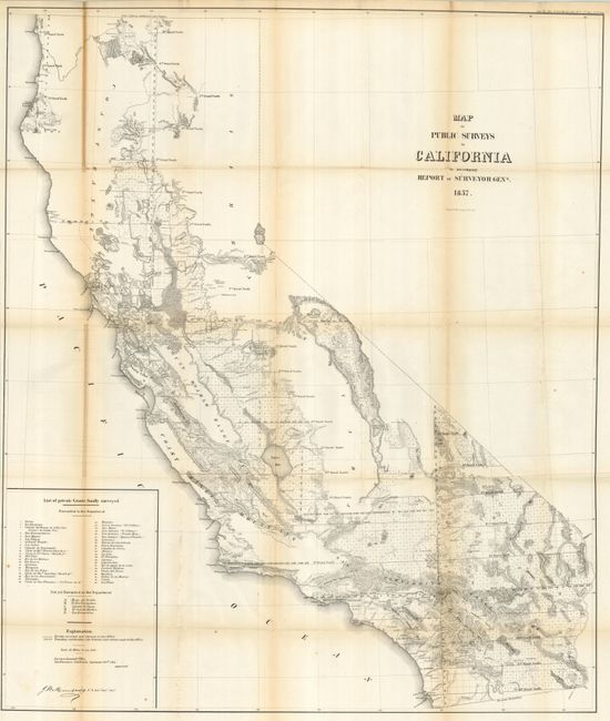
This large and remarkably detailed map delineates the progress of public surveys throughout the state on the scale of 18 miles per inch. About one-third of the state, in the north and east, remains unsurveyed. A large inset at lower left lists 43 private grants "finally" surveyed plus five others not yet forwarded to the Department. Topography is by hachure. The map shows in high clarity the watershed, railroads, towns and villages, springs, missions, forts, etc. Lake Tahoe is shown fairly accurately, but is still called Bigler Lake. Signed in the plate by J. W. Mandeville, U.S. Survey General of California.
References:
Condition: B+
Folding as issued. The map has a nice impression with full margins, but the left vertical fold is toned, more strongly at upper fold panel.