Subject: Alaska
Period: 1825 (published)
Publication: Atlas Universel
Color: Hand Color
This group of maps features portions of the Alaskan coastline. The Atlas Universel was the first atlas to present all the maps on the same scale (1: 1,641,836), with each map covering an area of approximately 20 degrees longitude (from Paris) and 6 degrees of latitude. It was also considered to be the first lithographic atlas ever published. The maps were meant to be joined together to form a huge globe measuring 7.775 meters in diameter. There was only one edition of the atlas, published in 1825-27, and the subscription list shows that only 810 copies were sold. Lot of three maps to include the following.
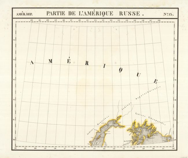
Amer. Sep.- No.13. Partie De L'Amerique Russe., (21.8 x 21.7") Locates Prince William Sound, Port Bainbridge Island, and Montague Island. The Indian lands of the Kenaitzes, Ougatachmioutis, and Tchougatches are named.
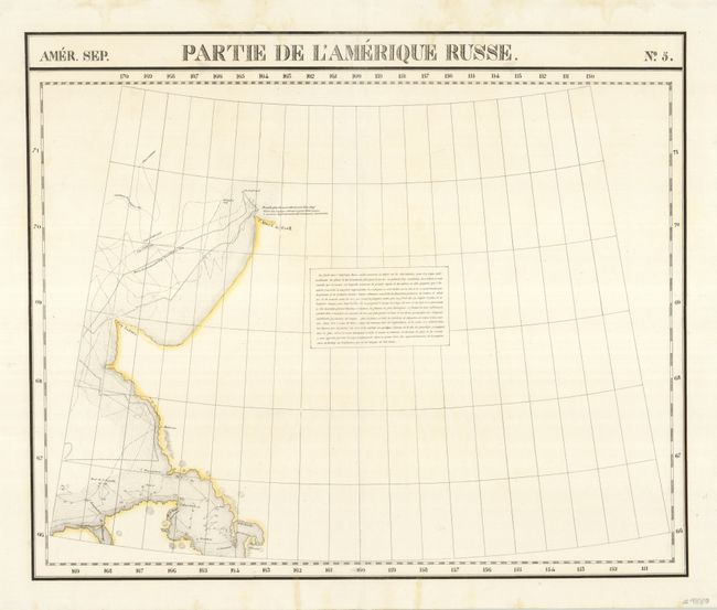
Amer. Sep.- No.5. Partie De L'Amerique Russe., (22.8 x 19.0") Shows the northern portion of Alaska's western coastline in the area of Kotzabue and Selawic and up to C. Glace de Cook, probably Point Hope.
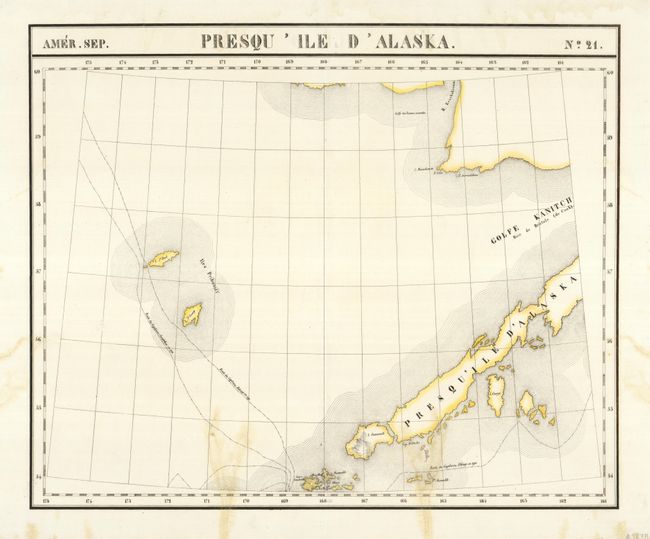
Amer. Sep.- No.21. Presqu ' Ile D'Alaska., (22.97x 18.6") The chart shows the islands of St. Paul and St. George, a portion of the Aleutian peninsula to include what we know today as Cold Bay, and a small portion of the mainland in the vicinity of Security Cove and Nanvak Bay. Shows the tracks of Captain Bilings in 1790-91 and Captain Sarylchew in 1791.
References:
Condition: A
The first two are near fine, the third map has an area of staining most likely from flower pressing.