Subject: Southwestern United States
Period: 1862-1875 (dated)
Publication:
Color: Hand Color
Size:
14.4 x 11.6 inches
36.6 x 29.5 cm
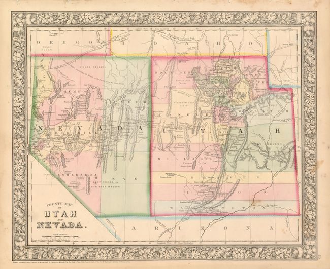
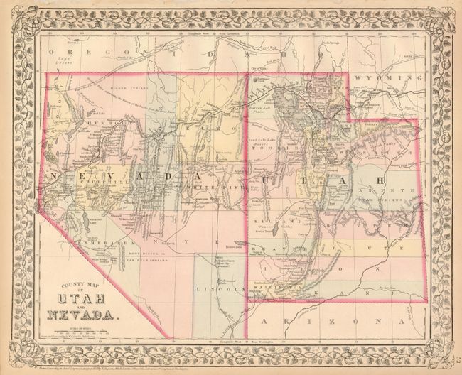
This is a great pair of maps that show the rapid pace of settlement, discovery and the changing political boundaries from the Civil War to 1872. The earlier map shows Nevada when its southern tip was part of Arizona Territory and with its border with Utah at 115°. It delineates seven counties in Nevada and fifteen in Utah. In the latter, Nevada has gained its southern tip and has also gained eastern territory with the Utah/Nevada boundary moved to 114°, where it rests today. In only seven years Nevada has created five more counties and Utah has added at least three new counties. Both measure approximately as noted and are surrounded by Mitchell's signature floral borders. A great pair for historical comparisons.
References:
Condition: A
The 1865 map has one spot in southeastern Utah and a few marginal.