Subject: Southwestern United States - Colona
Period: 1859 (published)
Publication: Illustrated Family Atlas
Color: Hand Color
Size:
15.6 x 12.8 inches
39.6 x 32.5 cm
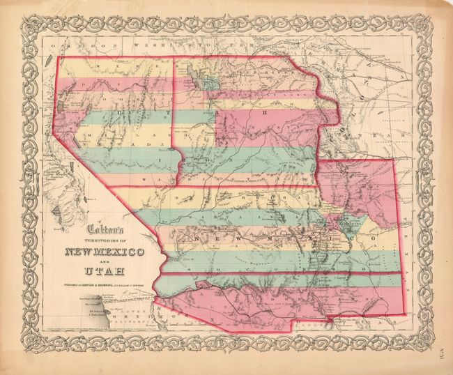
This is the scarce issue of Colton's great map of the American Southwest featuring the provisional territory of Colona, which became Colorado in 1861. Both the territories of Utah and New Mexico are shown in a transitional state with boundaries of the proposed new territories. The proposed territory of Arizona is shown to the south of New Mexico. The newly proposed territory of Nevada is shown taking in the western part of Utah with the border at the 114th meridian, but wandering south-south-east from Preuss L. to form a boundary along the Spanish Trail. The engraver has not changed the Utah label so 'Utah' stretches across both territories with Nevada identified only in small letters below. Further east is part of Kanzas and Nebraska. The map locates numerous early exploration routes, mail routes and proposed routes for the Pacific Railroad, and much more. Surrounded by Colton's distinctive scroll border. Dated 1855, and published circa 1859-60. See the previous lot for an example of an earlier edition of this spectacular map.
References: Wheat (TMW) #832.
Condition: A
Lovely example with fine map image featuring original full color, very strong, early impression and full margins. A little toning in blank margins, more at upper left apparently from old framing and a few marginal tears closed on verso with non-archival tape.