Catalog Archive
Auction 131, Lot 265

"[Lot of 2] Plan of the Junction of the Colorado and Gila Rivers… [and] [Untitled - Colorado River]", Whipple, Amiel Weekes

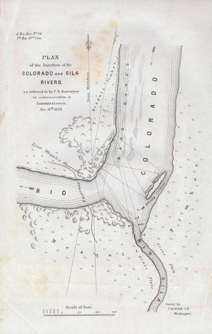
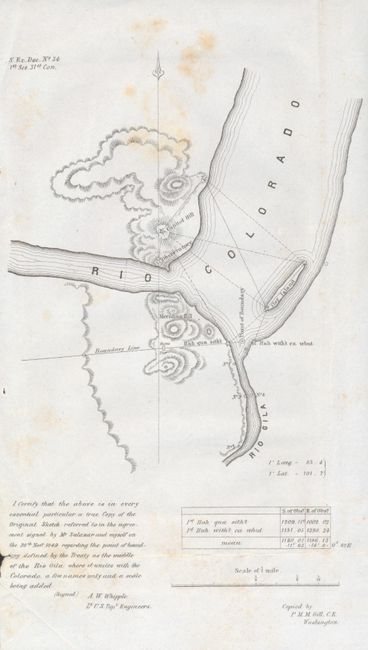
Subject: Southwestern United States

Period: 1849 (dated)

Publication: S. Ex. Doc. No. 34, 31st Cong., 1st Sess.

Color: Black & White

Size:
5 x 8 inches
12.7 x 20.3 cm
Download High Resolution Image
(or just click on image to launch the Zoom viewer)

This pair of maps are from the same publication and show the same portion of the Colorado River. Locates 'Mezquit' timber, Whipple's river crossing and surveying details. The untitled map includes a certification at lower left concerning the agreement with the Mexican representative on the exact location of the middle of the river as set in the treaty. Wheat says "These maps united in showing the peculiar northwesterly trend of the Colorado which gave to the United States both its banks for some seven miles below the mouth of the Gila." A historically important pair of Mexican/American border maps, both compiled by P.M.M. Gill.

References: Wheat (TMW) 650.

Condition: B+

Both with an area of foxing at upper center, otherwise very good.

Estimate: $80 - $120

Sold for: $110

Closed on 3/17/2010

Archived