Subject: Western United States
Period: 1861-62 (circa)
Publication: General Atlas
Color: Hand Color
Size:
22.5 x 17.3 inches
57.2 x 43.9 cm
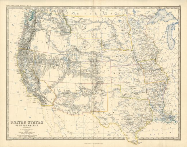
This is a terrific and historical map detailing the states and territories west of the Mississippi River. Very finely engraved with remarkable detail throughout, the map shows a pivotal and fascinating period in America's westward expansion and state development. Washington Territory extends to the Continental Divide and Oregon has its 1859 statehood boundaries. Idaho has a most unusual configuration containing all of Wyoming, but not its northern portion which is still shown as part of Washington. The large Dakota Territory stretches the Rocky Mountains at the Continental Divide and Minnesota far to the east. The large territory of New Mexico includes all of Arizona, and part of Nevada, but Colorado has formed, removing the northern area for the territory. The oversized Utah Territory still contains a portion of Nevada with the boundary on 116°; this border will in two steps move to its final position at 114°. Okalahoma and its panhandle is Indian Territory. Keyboard-style border surrounds.
References:
Condition: A
Short centerfold split at blank upper and lower blank margins, otherwise fine. Fine impression and color, with full, original margins.