Subject: Central United States
Period: 1884 (dated)
Publication: 5th Annual Report Bureau of Ethnology
Color: Hand Color
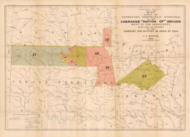
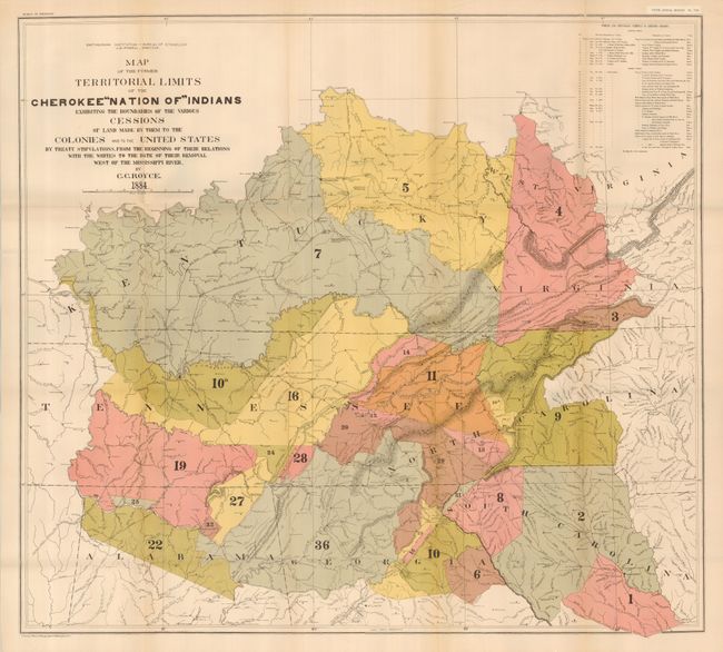
A matched pair of important Cherokee Nation maps. The first title continues, "...Made by Them to the Colonies and to the United States by Treaty Stipulations, from the Beginning of Their Relations with the Whites to the Date of Their Removal West of the Mississippi River." It shows the former territorial limits of the Cherokee Nation between the Ohio and Tennessee rivers and the Appalachian Mountains. Key lists 36 cessions from 1721 to 1835 which are numbered and colored on the map (31 x 28"). The second map's title continues "Also the Boundaries of the Territories Now Occupied Or Owned by Them" and lists cessions 37-47, Treaties of May 6, 1828 and July 19, 1866. This map also includes a small section of Public Lands, Kansas and Arkansas. Shows many villages, forts and Indian Agencies (30 x 20.5"). A terrific pair of large maps portraying an important period in Native American history.
References:
Condition: B+
Both folded as issued and printed on very thick paper. Both with just a hint of toning along some folds and a little weakness on some folds from the thickness of the paper, supported on verso with archival tape.