Subject: World
Period: 1552 (circa)
Publication: Cosmographia
Color: Hand Color
Size:
15 x 10.3 inches
38.1 x 26.2 cm
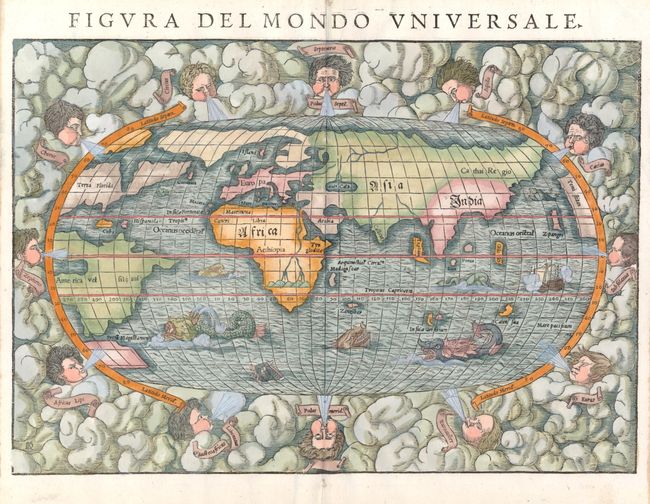
This famous woodblock map is presented on an oval projection surrounded by clouds and wind heads with the title above the map. The continents are shown in rough outline only. North America is depicted with the large cleft nearly separating the east coast from the rest of the continent. The large sea, often referred to as the Sea of Verazano, opens in the north to a wide Northwest Passage that stretches towards Asia. South America has a very strange shape as well. In Africa, the Nile is prominently shown with its twin sources beginning in a range of southern mountains. The mythical islands of Grisonum and Calensua are placed in the proximity of Australia, where there is also the label Mare Pacificum. A sailing ship and several fierce sea monsters occupy the oceans. The initials of the engraver David Kandel are in the lower left-hand corner. This is the second 'modern' world map to appear in Munster's Cosmographia, published between 1550 and 1578. This example is from a French edition with French text on verso.
References: Shirley #92; Manasek #12.
Condition: A+
A very nice impression printed on good paper. The usual tiny binding holes in the blank margins, which have been expertly filled.