Subject: United States - Midwest
Period: 1868 (circa)
Publication:
Color: Hand Color
Size:
23.4 x 17 inches
59.4 x 43.2 cm
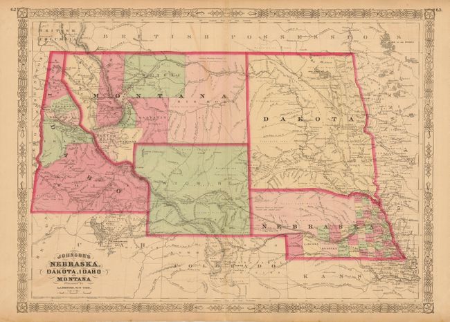
This colorful double-page map shows a very early rendering of Wyoming Territory, organized in 1868. The territory's western boundary is not correctly formed; extending here into present-day Idaho in the northwest, with Idaho taking up the present-day Wyoming region south of Jackson Hole. There are no counties established. It correctly shows Montana which, along with Wyoming, was previously contained in a large Idaho territory. Dakota Territory, from which Wyoming was formed, remains undivided. There is excellent detail throughout with scores of place names, roads, watershed, topography, the Emigrant Road, forts, springs, and lots more. The map retains the 1865 copyright date, but was published circa 1868. Census information on verso.
References:
Condition: B+
Lovely original hand coloring. A trace of toning at lower centerfold and one light swipe of toning in Montana.