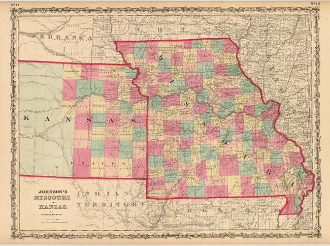
Subject: Central United States, Missouri and Kansas
Period: 1860 (circa)
Publication: Illustrated Family Atlas of the World
Color: Hand Color
Size:
23 x 17 inches
58.4 x 43.2 cm
This is an uncommon issue that correctly spells Kansas on the map but uses the spelling with "z" in the title, similar to Colton's earlier issue. Shows all of Missouri, but only the eastern portion of Kansas to roughly 99° or about to today's Great Bend. Settlement within Kansas stops at Washington, Clay and Dickison counties with a line further west labeled "Western Limit of Habitable Land." Locates the "U.S. Mail Route," Santa Fe Road, and many other historic details.
References:
Condition: A
A really beautiful example with a strong, early impression and lovely original hand coloring and full margins. A fine example less a hint of offsetting in blank areas outside map image as a result of the strong impression.