Catalog Archive
Auction 131, Lot 246

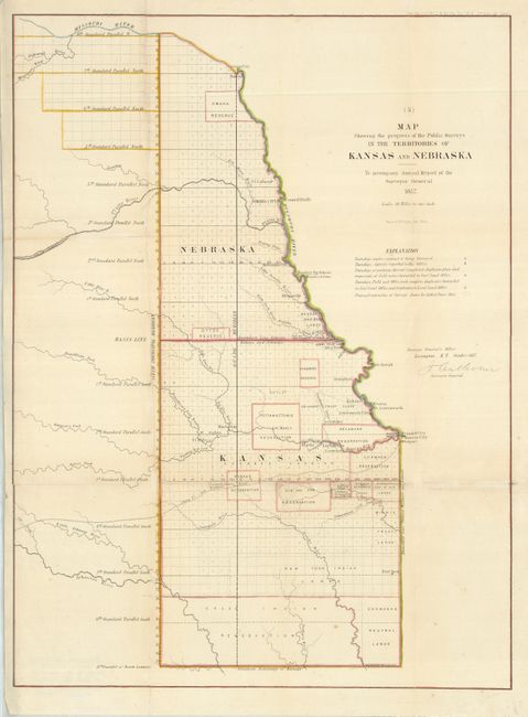
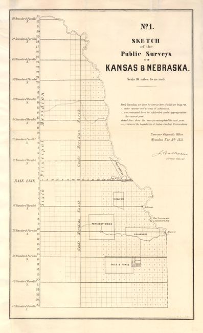
"[Lot of 2] Map Showing the Progress of the Public Surveys in the Territories of Kansas and Nebraska [and] No. 1 Sketch of the Public Surveys in Kansas & Nebraska", U.S. State Surveys

Subject: Central United States, Nebraska, Kansas

Period: 1855-57 (dated)

Publication:

Color:

Size:
See Description
Download High Resolution Image
(or just click on image to launch the Zoom viewer)

These two map were prepared for the Annual Report of the Surveyor General to show the progress of surveys and the Indian Reservations and land trusts. They provide an interesting picture of the rapid progress of the surveys and most importantly the expansion of the Indian Reservations during this period. First map, with later hand color, measures 17 x 23.3" and the second is uncolored (11.8 x 20").

References:

Condition: B

Issued folded, now flattened. Both with reinforced folds. The first chart, with added color, includes some paper replacement at fold intersections. The second map has been remargined at left with facsimile of the neatline.

Estimate: $150 - $200

Sold for: $100

Closed on 3/17/2010

Archived