Subject: Midwestern United States
Period: 1795 (published)
Publication: The United States Gazetteer
Color: Black & White
Size:
6 x 7.2 inches
15.2 x 18.3 cm
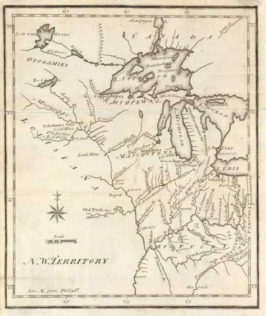
This is the earliest printed map to show the North West Territory. It covers the region of the upper Mississippi Valley and the Great Lakes, and shows the rivers and streams together with settlements, mines and forts. Lit. Fort appears at the mouth of the Chicago River and Old Ft. Orleans appears on the Missouri River. The southern end of Lake Michigan is placed almost a full degree further north than the southern shore of Lake Erie, an error that resulted in a series of boundary disputes between Michigan and its neighbors in the 19th century. The fictitious Charlevoix-Bellin islands appear in Lake Superior. This is the first state with small, plain circle icons to locate the towns of Detroit, Sandusky, etc.
References: Karpinski (MI) p. 189; Wheat & Brun #674.
Condition: B+
Folded as issued. A couple very light offsetting marks and short fold separations repaired with Japanese tissue.