Subject: Southern United States - Kentucky and Tennessee
Period: 1794 (published)
Publication:
Color: Hand Color
Size:
17.7 x 14.8 inches
45 x 37.6 cm
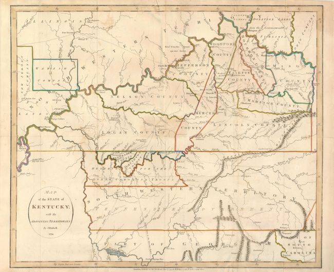
This is an important map depicting the entire state of Kentucky, most of Tennessee (labeled as South Western Territory), and the northern part of Georgia. The best map of the trans-Appalachian frontier, it was issued only two years after statehood for Kentucky and before Tennessee became a state. Within Kentucky, ten counties are delineated and pioneer roads (called traces) are shown throughout both Kentucky and Tennessee. Towns such as Lexington, Louisville, Nashville, Knoxville, Boonsborough, and even mills and orchards are denoted. Of particular interest are the depictions of the planned, but never built, utopian settlements of Somerset and Franklinville. Several Bounty Land Grants are shown in the adjacent territory.
References:
Condition: B+
Issued folded, now flattened, with several old paper repairs to the folds on verso. There is some offsetting and minor soil in the map.