Subject: Southeastern United States, South Carolina
Period: 1780-1815 (published)
Publication:
Color: Hand Color
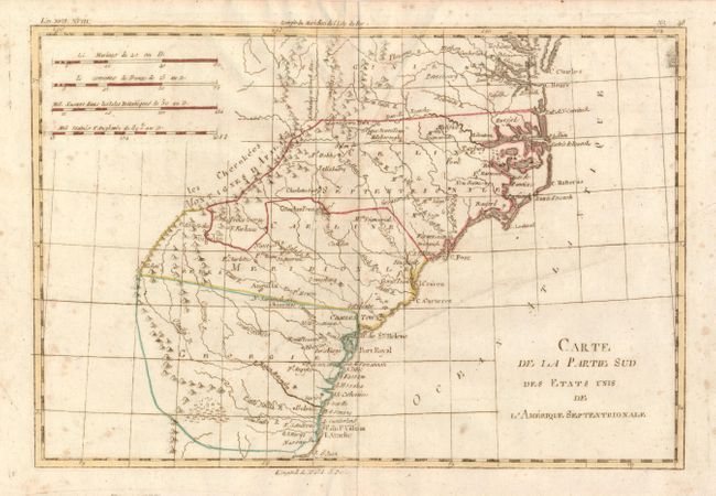
Carte de la Partie Sud des Etats Unis de L'Amerique Septentrionale, Rigobert Bonne, circa 1780, 12.3 x 8.3". Simple yet concise copper engraved map covers the states of Virginia, North and South Carolina, and Georgia in the newly created United States. All settlement is confined east of the Appalachians with les Cherokees the only note in the otherwise blank region west of the mountains. There are four distance scales located on the left side of the map. Engraved by Andre. Published from Paris in Raynal's Atlas de toutes les parties connues du Globe Terrestre. Printer's crease mostly in blank Atlantic and some light scattered foxing (B).
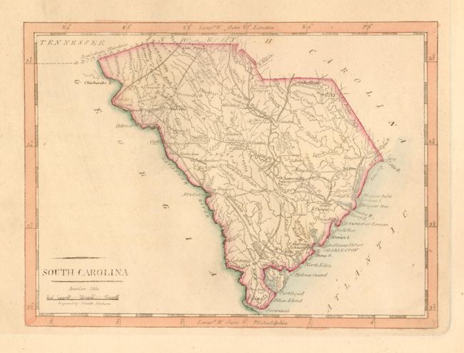
South Carolina, by Matthew Carey, 1815, American Pocket Atlas, 7.6 x 5.6". This is delicately engraved map that details topographical features, watershed, towns and villages and the road network throughout the state. Locates Four Holes Swamp north of Charleston. The distance scale is indicated in American Miles. Engraved by Doolittle. Original hand coloring and nice impression with wide margins at sides and bottom as issued (A).
References:
Condition:
See individual descriptions.