Subject: Southeastern United States
Period: 1801 (published)
Publication: Crevecoer's "Voyage dans la Haute Pennsylvanie
Color: Black & White
Size:
20 x 14 inches
50.8 x 35.6 cm
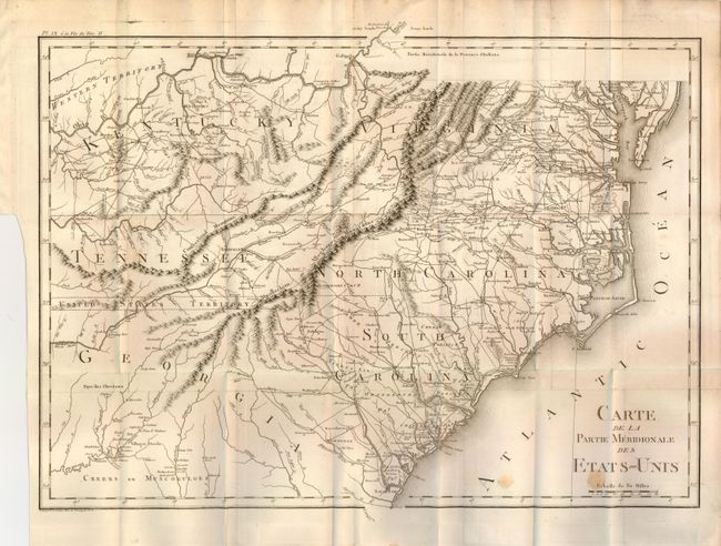
This finely engraved map describes the southern portion of the United States at the turn of the century. The map extends from Savanna to the Chesapeake Bay and east to show Kentucky, Tennessee and the Western Territory above the Ohio River. A thin strip of land extending westward between Georgia and Tennessee is called United States Territory. This region originally belonged to South Carolina but was ceded back to the United States in 1787. The map is filled with a remarkable number of place names and details including a well developed road system within the nascent nation. A large amount of information on Indian tribes and villages is included. The map is from Crevecoeur's three volume work Voyage dans la Haute Pennsylvanie. Crevecoeur was a French immigrant to the United States who gain notoriety describing the emerging American national character in his Letters of an American Farmer, 1782.
References:
Condition: B+
Beautiful, early impression on thick paper with original margins. Folded as issued. Two spots at lower right otherwise a very good or fine example.