Subject: World & Continents
Period: 1694 (published)
Publication: Introductio in Universam Geographicam
Color: Hand Color
A fine matched set of maps from a German edition of Cluver's popular geography published by the heirs of Conrad Buno at the court of Wolfenbüttel. This set presents an interesting comparison of the variety of cartographic theories prevalent at the turn of the eighteenth century. Even though the maps were all published in the same atlas, the world map is quite different than the continental maps. The world map measures 12 x 6.3"; others approximately 10 x 8" with some variations in size.
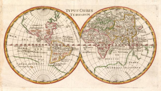
1) The simple, double hemisphere world map depicts mid-seventeenth century geography with the partial shorelines of a large Terra Australis Incognita and the rudimentary beginning of an unnamed Australian continent. In North America, California is a peninsula with Quivera and Anian expanding the continent too far west.
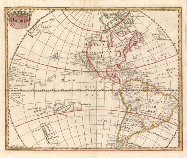
2) This handsome small map of the Americas was derived from the Nicolas Visscher map of 1658, with a Briggs type island of California. A depiction of the discoveries of the De Vries voyage appears in the water north of Japan and Tasman's discoveries are exhibited in New Zealand, shown as Zelandia Nova. The land of Anian is noted with a Straet Anian running between it and the Anian regnum. The title is enclosed in a simple drape-style cartouche. The map was engraved by Herman Mosting.
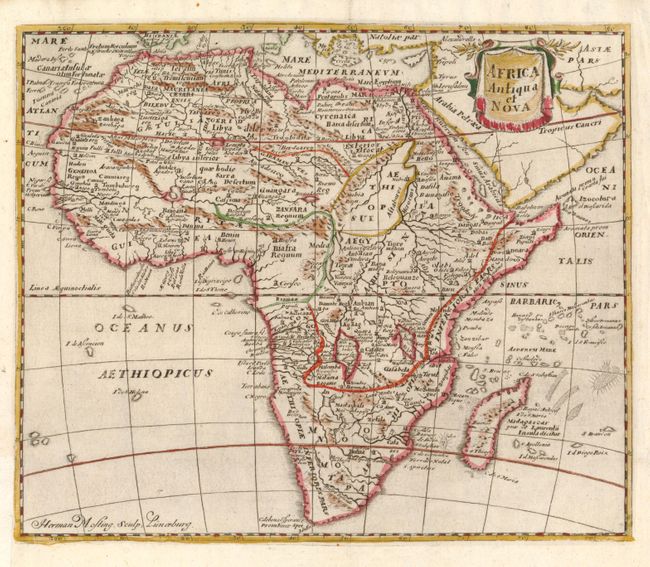
3) The map of Africa shows typical seventeenth century cartography with the Nile rising from twin lakes below the equator and spurious details in the interior. The title is enclosed in a simple drape-style cartouche. Engraved by Herman Mosting.
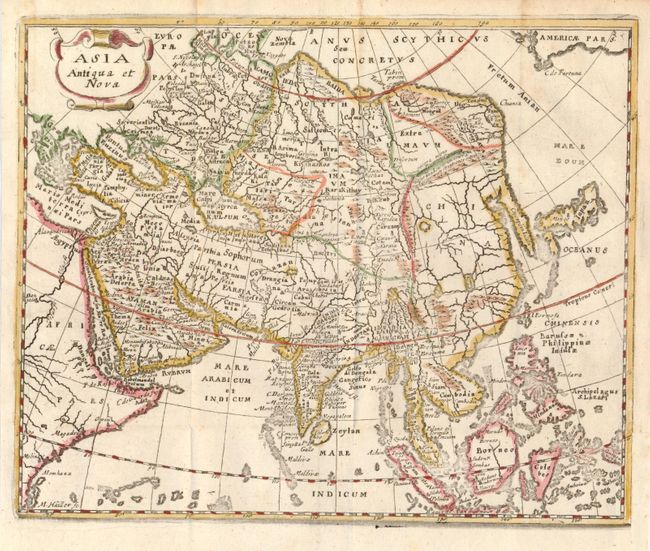
4) The Asian map extends to include Japan, the Philippines and most of Indonesia. The outline of Asia follows the Mercator-Hondius model with the Arctic and extreme northeast coastlines truncated, an elongated Korean peninsula and a narrow Indian subcontinent. There are numerous place names except in China, which is strikingly void of any names and filled with a bold network of rivers and large lakes. The title is enclosed in a simple strapwork cartouche. Engraved by Martin Hailler.
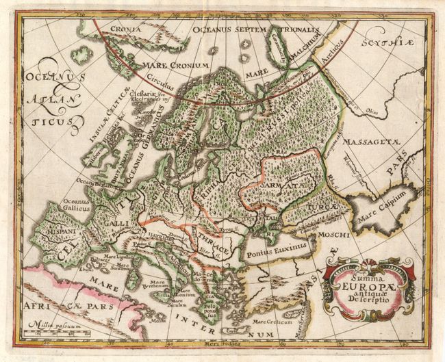
5) The map of Europe shows its ancient divisions, as it was in the time of the Roman emperors, and is fully engraved with forests. The strapwork title cartouche includes garlands at the sides.
References: World, Shirley #425; Americas, Burden #360 &McLaughlin #25-2; Africa, Betz #140; Asia, Yeo #27.
Condition: A
Issued folded, now flattened with binding trims replaced to accommodate framing.