Subject: Colonial Mid-Atlantic
Period: 1757 (circa)
Publication: l' Histoire Generale des Voyages
Color: Black & White
Size:
11.3 x 7.5 inches
28.7 x 19.1 cm
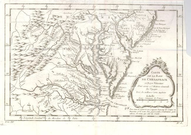
Finely engraved colonial map covering most of Virginia, Maryland, Delaware with a bit of Pennsylvania and New Jersey. The interior is fully engraved with mountains and great detail along the rivers. An early network of trails and wagon roads are delineated, plus watershed and some topographical information. It extends west to beyond Fort Cumberland and locates Annapolis, Fredericksburg, Williamsburg, Norfolk, and Philadelphia. The delicate rococo-style title cartouche incorporates the distance scale.
References: Sellers & Van Ee #1383.
Condition: A
Delicate impression on clean paper with full margins. Apparent discoloration along vertical fold is actually a darkened line on verso, otherwise a fine example that has been left uncolored, as issued.