Subject: Colonial New England and Mid-Atlantic
Period: 1757 (dated)
Publication: Prevost's Histoire Generale des Voyages
Color: Hand Color
Size:
11.8 x 8 inches
30 x 20.3 cm
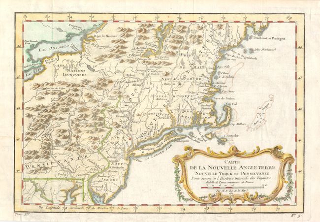
This French & Indian War period map details the English colonies from Pennsylvania through to Castine, Maine with their early boundaries. It is fully engraved with topographical features and includes many early place names. The colonies are shown confined east of the Allegheny Mountains with the Nations Iroquoises, Indian villages, and several French forts located west of the mountains. It extends to show Lake Ontario and most of Lake Erie. A flourishing French rococo-style cartouche with distance scale decorates the map. This version, dated 1757, varies from the first edition noted in the references with slightly different volume and plate numbers below the bottom neatline.
References: cf McCorkle #757-1; Sellers & Van Ee #721.
Condition: A
Issued folded, now flattened with the binding trim at lower left side neatly replaced to accommodate framing.