Catalog Archive
Auction 131, Lot 212

"Rand McNally & Co.'s Vermont and New Hampshire", Rand McNally & Co.

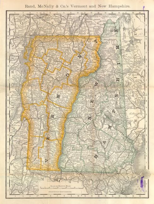
Subject: New England, Vermont & New Hampshire

Period: 1877 (dated)

Publication:

Color: Printed Color

Size:
9.3 x 12.5 inches
23.6 x 31.8 cm
Download High Resolution Image
(or just click on image to launch the Zoom viewer)

This pocket map is an early edition for Rand McNally. The map is precisely engraved and filled with information on towns and villages, roads, railroads, watershed and topography. Blank verso. Map folds into brown cloth boards with stamped gilt title "Rand McNally & Co.'s Indexed Map of New Hampshire and Vermont." Twelve page Index to counties and towns. Inside front paper label lists other map publications available from the company. Map undated, but the booklet is 1877.

References:

Condition: A

Map has a trace of fold toning and an old ink drip at upper & lower right corners. The covers are fine with no flaws as is the booklet. A lovely example.

Estimate: $120 - $160

Sold for: $70

Closed on 3/17/2010

Archived