Subject: Colonial New England
Period: 1759 (published)
Publication: Royal Magazine
Color: Hand Color
Size:
14.8 x 11.3 inches
37.6 x 28.7 cm
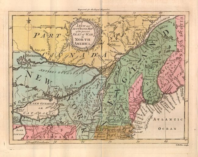
This is an interesting map of New England and Eastern Canada showing the region disputed in the French and Indian War from a British point of view. New York is shown to include present day Ontario and New England's northern boundary is the St. Laurence River. New York extends north of Lake Ontario and Lake Erie is here called Lake Oswego. Above upper neatline is "Engraved for the Royal Magazine" and in smaller lettering at lower right is "G. Rollos sculp." Published in the November 1759 issued with a related article beginning on page 223.
References: McCorkle #759-4; Sellers & Van Ee #85; Jolly ROYMAG-5.
Condition: A+
A fine example with full margins, dark impression and strong original coloring. On thick hand laid paper with large watermark.