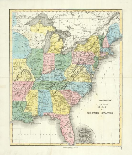
Subject: Eastern United States
Period: 1850 (dated)
Publication:
Color: Hand Color
Size:
17 x 20.8 inches
43.2 x 52.8 cm
This uncommon Scottish produced map shows an out-of-date cartographic picture that does not include the newly acquired lands in the west. The map extends beyond the Mississippi River to include part of Iowa, Missouri, Arkansas and Louisiana. Each state is individually colored with good detail of watershed, towns and settlements, railroads, and some topographical information. The railroads are particularly well shown. Michigan is shown as a territory and to the west is the large Northwest Territory. Engraved by W. Murphy. Blank verso and page XLIV at lower right. A large and handsome sheet.
References:
Condition: A
Short split on centerfold in margin professionally closed with tissue and a couple short marginal tears, also well repaired on verso.