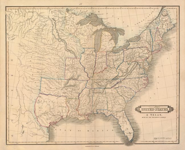
Subject: Eastern United States - Texas
Period: 1840 (published)
Publication: Edinburgh Geographical General Atlas
Color: Hand Color
Size:
20.4 x 16.3 inches
51.8 x 41.4 cm
The Republic of Texas is a prominent feature of this interesting map of the growing United States. The map extends west to about the 109th meridian where the headwaters of the Missouri are illustrated. The new state of Missouri is shown with a straight western border. The large Arkansas Territory takes in most of present-day Oklahoma. Northwest Territory includes Wisconsin and much of Minnesota. The Great Desert takes in the central plains and is occupied by a number of Indian nations. The Republic of Texas is shown in a small format with the southern boundary with Mexico formed by a dotted line between the Nueces and Rio Grande rivers.
References: Phillips (A) #782-63.
Condition: B+
Original outline color with a bit of faint offsetting. There are two unobtrusive Arabic manuscript notations, inside the title block and above the top margin. The centerfold has been expertly reinforced on verso.