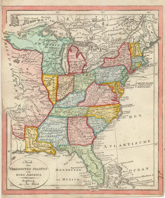
Subject: Eastern United States and North America
Period: 1820 (circa)
Publication: Neuester Schul-Atlas
Color: Hand Color
Size:
7.8 x 9 inches
19.8 x 22.9 cm
1) Nice little German map from a school atlas. It covers the eastern United States with large territories including Michigan Territory, Missouri Territory, North West Territory and Mississippi Territory. West of the Mississippi River is the huge Missouri Territory. The N.W. Territory fills the region between the Mississippi River and Lake Michigan and is bounded in the north by Lake Superior.
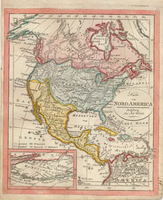
2) Very uncommon small map illustrating primarily topographical features. The United States boundaries are irregularly formed, bearing little resemblance to reality. The European possessions are reflected by color. Mexico includes the Southwest and New Mexico has a horn-shaped extension reminiscent of the later northern portion of Texas with an early border.
References:
Condition: A
Both very nice.