Subject: Eastern United States
Period: 1818 (circa)
Publication: Carey's General Atlas
Color: Hand Color
Size:
17.3 x 13 inches
43.9 x 33 cm
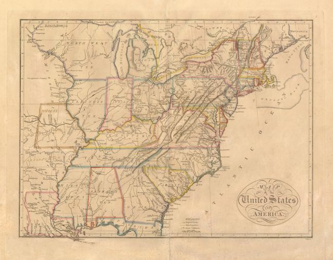
This map of the young United States extends just beyond the Mississippi River. The mid-western territories are a bit misaligned with Indiana shown directly below Lake Michigan and Chicago appearing in North West Territory. West of the Mississippi River is the large Missouri Territory stretching northwards from Louisiana. A previous owner has sketched in the state of Misouri [sic] and Arkansaw Ter. in brown ink. Major roads with distances, proposed canals, cities, forts, and Indian villages are among the interesting details illustrated on the map.
A notation of Yazoo Speculation in Mississippi refers to the Yazoo Land Fraud perpetrated in 1789-1796 when the region was part of Georgia Territory. Three companies bribed and intimidated a bill through the Georgia assembly that allowed them to purchase millions of acres of land for next to nothing, resulting in a huge public outcry. The bill's supporters were swiftly voted out of power, and Senator James Jackson took office. He vowed to repeal the Yazoo Act if it cost him his life, saying he would repeal it even if he had to shoot everyone involved in passing it. He didn't have to shoot anyone, and the law was rescinded in 1796. The fact it is shown on a map produced many years later attests to the importance attributed to this fraudulent scheme.
References:
Condition: B
Lightly toned with some minor foxing and a tissue reinforced centerfold. Manuscript notations as described.