Subject: United States
Period: 1863 (published)
Publication: Mitchell's New General Atlas…
Color: Hand Color
Size:
21.5 x 13.5 inches
54.6 x 34.3 cm
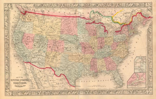
This attractive map features early boundaries for the territories of Dakotah, Idaho, Utah and Arizona. There is no sign of Wyoming or Montana as they are still incorporated into the huge rectangular Idaho Territory. Arizona still includes the southern tip of Nevada. Extensive railroad network throughout the east, with the proposed Pacific Railroads, mail routes, emigrant roads and the Pony Express route shown in the west. Insets of Hampton Roads and Norfolk Harbor, and Pensacola Bay. Surrounded in a floral border. Imprint dates the map to 1860 but it was published in 1863. Xerox copy of atlas title page included.
References:
Condition: A
A very nice example with bright original hand coloring and full margins. No flaws save for a split in the lower margin that just enters the border, closed on verso.