Subject: United States
Period: 1861 (circa)
Publication:
Color: Hand Color
Size:
16.8 x 10.5 inches
42.7 x 26.7 cm
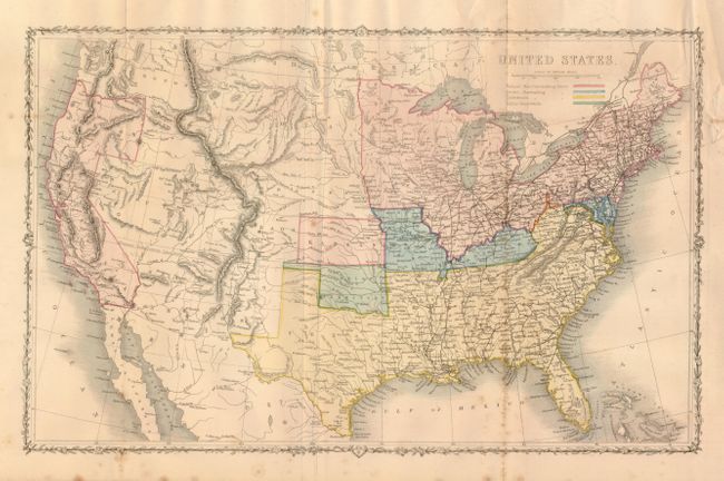
Fine map covers the entire country, issued just prior to the beginning of the Civil War, which is the main focus of the map. The legend uses color to indicate Federal Non-Slaveholding States, States bordering Slaveholding States, and the Confederate Slaveholding States. Also indicates the Indian Territory with its own color. The large Washington Territory, is depicted in the short-lived inverted 'L' configuration, extending east to the Continental Divide and south to the Utah Territory. The proposed Territory of Arizona is shown in the southern part of New Mexico Territory. A huge Dakota Territory extends from Minnesota to Washington. Surrounded by a decorative vine and leaf border. An uncommon pre-Civil War issue that was published by the London Printing and Publishing Company.
References:
Condition: B+
The map has some foxing along one vertical fold in lower half and a short binding trim tear closed on verso and some miss-folding in the same area.