Subject: United States
Period: 1860 (dated)
Publication:
Color: Black & White
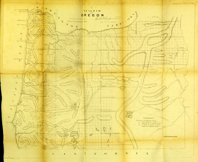
This 8vo document contains 23 maps and plates including GLO maps (10) and numerous others including the Dixon map of the route from the Dalles to Salt Lake and maps and a view of the new Government Insane Asylum, later St. Elizabeth's Hospital, and now the new Headquarters of the Department of Homeland Security. A few of the maps include: Map Showing the progress of the Public Surveys in the Territories of Kansas and Nebraska (first map bound in so it has long fold splits and toning); Sketch of the Public Surveys in the State of Minnesota; A Diagram of Oregon; Map of Public Surveys in California (long split); Map of the State of Florida; No. 8 (II) Map of Louisiana; (No. 1) Sketch of the Public Surveys in the State of Wisconsin; (No. 2) Sketch of the Public Surveys in Iowa and Dakota; Map of a Part of Washington Territory; Sketch of Public Surveys in New Mexico; and Survey of the N. & N.W. Lakes Showing the Progress of the Survey in Lake Michigan. The large "Map Exhibiting the route between Fort Dalles and the Great Salt Lake" is by Bvt. 2nd Lieut. Joseph Dixon. It details Dixon's work while attached to the Wagon Road expedition under the Command of Capt. H.D. Wallen, 4th Infantry. Three related to the insane asylum: an elevation drawing, site plan and a ground plan. Also the "Design for the New Jail for the Dist. of Columbia, 1856".
References:
Condition: B
The maps have the usual tears and some soiling. Extreme conditions are noted above. Should be considered a set of maps that will benefit from backing.