Subject: United States
Period: 1822 (published)
Publication: Morse's A Report to the Secretary of War
Color: Hand Color
Size:
16 x 10 inches
40.6 x 25.4 cm
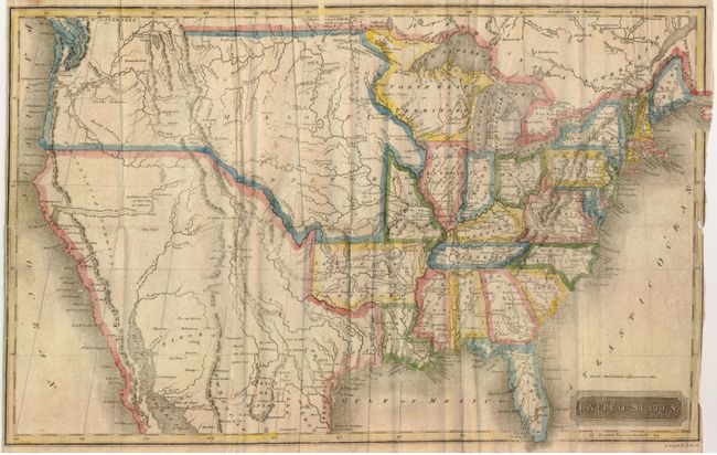
This uncommon map of the United States was engraved by A. Daggett and published from New Haven. The map uses original hand coloring to delineate each state and a few western territories. Arkansas is in it's large configuration extending to Mexico. Texas is named and is part of Mexico. The large North West Territory is bounded on the west by the Mississippi River and stretches to the lakes Superior and Michigan. The central plains and Northwest are labeled Missouri Territory with a portion extending into Canada labeled New Caledonia. In Utah a lake is shown whose "Western Limits…are unknown" and just to the east is the Valle Salado. An unknown river bisects the unnamed Great Basin with a hopeful notation predicting it "will probably be the communications between the Atlantic and Pacific."
References:
Condition: B+
Folding map with some lazy creases at some folds. With original hand-coloring on thin banknote-style paper. Some archival repaired tears on verso, close trimmed along sides with small loss at center right.