Subject: Canada & United States
Period: 1783 (dated)
Publication:
Color: Hand Color
Size:
19.7 x 16 inches
50 x 40.6 cm
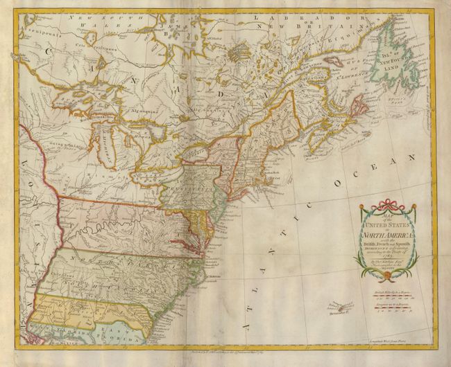
This is one of the earliest English-produced maps to officially acknowledge the United States. It depicts the new nation with its western border on the Mississippi River. The states of Georgia, South Carolina, North Carolina, and Virginia stretch from the Atlantic to the Mississippi. The map is filled with information on early settlements, forts, Indian villages and fishing banks. The title is enclosed in a simple cartouche, with the island of Bermuda below. Kitchin, Hydrographer to the King, prepared the map for a special publication by Thomas Cadell. It was subsequently issued in Raynal's history (1783-98) and possibly other publications.
References: McCorkle #783-11; Phillips (M) p. 862.
Condition: B+
Very fine impression and nice coloring. There are several professional repairs along centerfold in lower portion of map.