Subject: Colonial United States and Canada
Period: 1771 (dated)
Publication: Atlas Moderne
Color: Hand Color
Size:
17.2 x 11.6 inches
43.7 x 29.5 cm
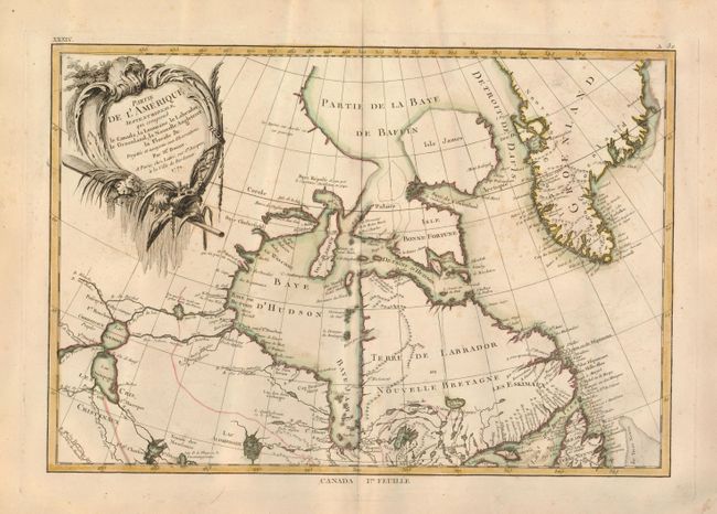
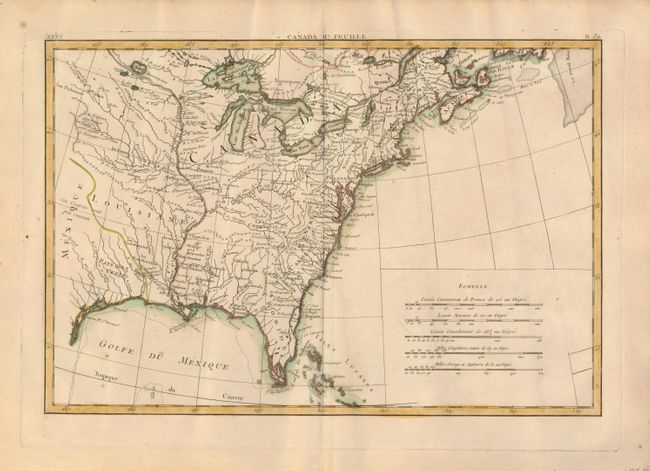
This finely engraved pair of pre-Revolutionary War maps delineates the Eastern parts of North America in the years leading up to the war. The first sheet contains the decorative title cartouche, and it covers eastern Canada and Greenland from the bottom of Hudson Bay, northward beyond the Arctic Circle to about 70 deg. N. Latitude. It includes an interesting depiction of a passage between Lake Winnipeg and Hudson Bay alluding to a possible passage to the Pacific. The second map covers French Louisiane and the British Colonies with their western boundaries indistinctly shown. Later editions of this map show the borders to the Mississippi River. Texas is Pays des Cenis. Many early place names, forts and Indian villages are identified. There is an early mention of les Kansez in the area of Kansas City. Five distance scales at lower right.
References: Kershaw #474; McCorkle #771.2.
Condition: B+
Very nice examples with fine, dark impression and nice hand coloring on thick hand laid paper with wide margins. The northernmost sheet has just a few small spots (B+), the southern sheet is very good (A).