Subject: Colonial United States and Canada
Period: 1763 (dated)
Publication: Annual Register
Color: Hand Color
Size:
12 x 9.5 inches
30.5 x 24.1 cm
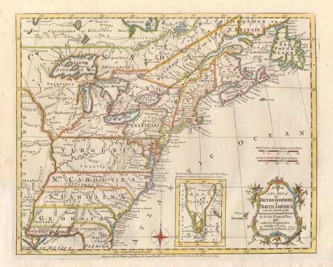
This very historical map illustrates the British colonies after the Treaty of Paris and at conclusion of the French and Indian War in America. The treaty ended French colonial ambitions in North America with minor exceptions. As a result Spain ceded East and West Florida to Great Britain, France relinquished the title to the Louisiana Territory to Spain, and the Mississippi River was established as the British-Spanish Boundary. The map reflects the claims of the southern colonies that their charters extended to the Mississippi River. Also of interest are the names and locations of many Indian tribes and nations located away from the more populated areas of English settlements. An inset of East Florida on the same scale lies between the coastline and the decorative rococo-style title cartouche.
References: McCorkle #763.5; Sellers & Van Ee #103; Jolly ANNREG-3.
Condition: A
Issued folded, now flattened with the binding trim at lower left and the bottom margin extended to better accommodate framing.