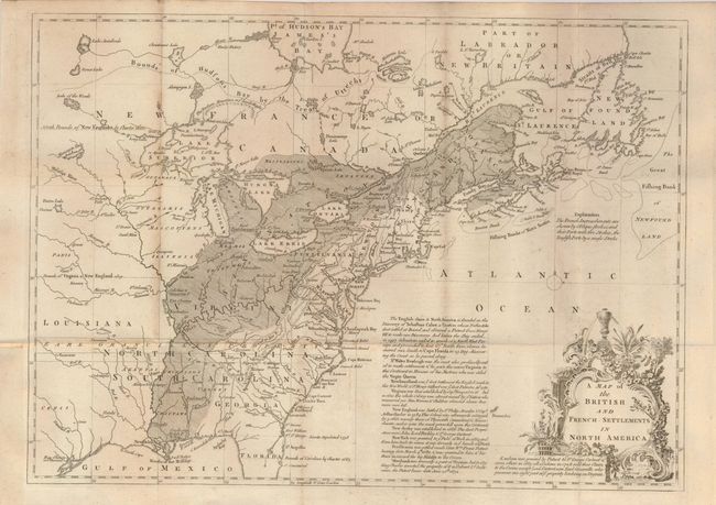
Subject: Colonial United States and Canada
Period: 1755 (circa)
Publication: Gentleman's Magazine
Color: Black & White
Size:
15 x 11 inches
38.1 x 27.9 cm
This is the first of several similar maps illustrating the French/British conflict in North America. It was issued just before the French and Indian War was officially declared and depicts, by hachure, the French encroachment into British claimed territory. Earl Granville's Property is shown in North Carolina and extending to the western-most edge of the map, which is about the 100th Meridian. Several treaty lines are shown in addition to British and French forts and numerous Indian tribes. Decorative title cartouche and lengthy description of the history of the colonies enhance the map. Published in the July 1755 issue.
References: Jolly GENT-91; McCorkle #755.24.
Condition: B+
Very nice example on thick paper with full margins, crisp impression. Paper laid in at binding trim to facilitate framing. A trace of light foxing mostly along one fold.