Subject: North America
Period: 1859 (circa)
Publication: Illustrated Atlas and Modern History of the World
Color: Hand Color
Size:
9.5 x 14 inches
24.1 x 35.6 cm
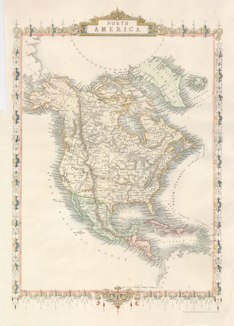
This is a later issue of this decorative map drawn and engraved by John Rapkin and issued without vignettes as normally seen. In the United States, the large Nebraska Territory fills the Midwest, meeting Washington and Oregon territories at the Continental Divide. Minnesota is also oversized as it extends to Nebraska at the Missouri River. Kansas has its western border at the Rocky Mountains, extending to Utah. New Mexico and Utah are at their largest extent. Surrounded by a decorative border.
References:
Condition: A+
Surrounding border hand colored. Very fine impression with margins more generous than normally seen with this issue.