Subject: North America
Period: 1846-55 (circa)
Publication:
Color: Hand Color
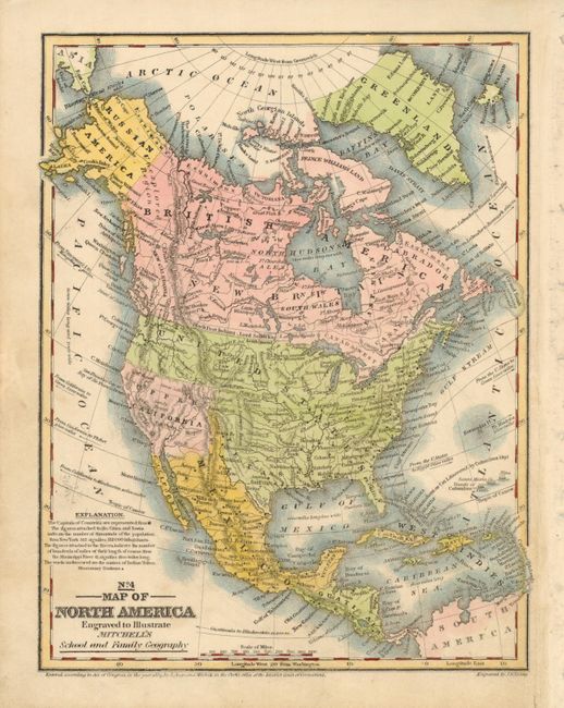
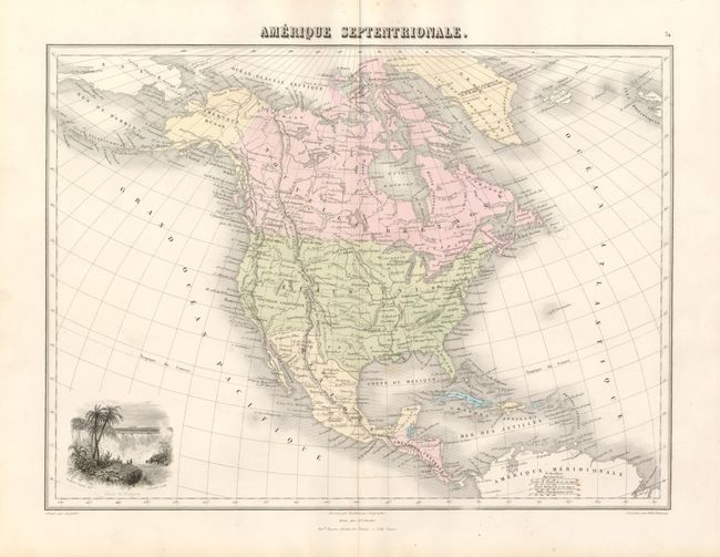
These two maps make a nice comparison of the changing political situation in North America in the middle of the 19th century.
1) No. 4 - Map of North America Engraved to Illustrate Mitchell's School and Family Geography (8 x 10.3"), dated 1839 but likely published in 1846 at the outbreak of the Mexican-American War. Texas is a part of the United States, Mexico controls the narrow strip of New Mexico, and Upper California is shown as a separate entity. Alaska is Russian America and Canada is labeled both British America and New Britain. Numerous Indian tribes are located throughout the western United States and Canada. The plains region is noted as the Great American Desert and the Great Basin is labeled the Sandy Desert.
2) Amerique Septentrionale, by J. Migeon for Desbuissons Geographe, (14.7 x 11.3") circa 1855. A nice map of the continent showing the national boundaries, but not the individual states and provinces. The United States is shown with its boundary with Canada completed; but the region is marked Oregon ou Columbia reflecting the recently settled dispute between Britain and the U.S. The boundary with Mexico is marked Limite d' apres le Traite de 1848 and follows the Gila River (pre-Gadsden Purchase). Alaska is Amerique Russe. Numerous Indian nations are located throughout. The most interesting feature of the map is the vignette, Chute de Niagara. This unusual view of Niagara Falls, drawn by Frederic Legrip, features the great falls surrounded by palm trees. Vignette engraved by Schroeder, map engraved by L.A. Sengteller.
References:
Condition: A