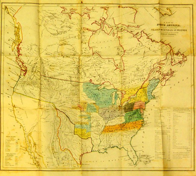
Subject: North America
Period: 1844 (dated)
Publication: ...Religious Society of Friends towards the Indian Tribes…
Color: Hand Color
Size:
21 x 18 inches
53.3 x 45.7 cm
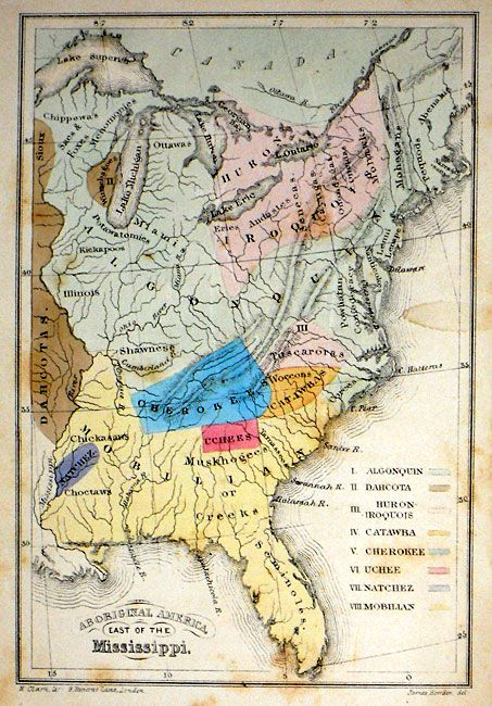
Very uncommon and unusual map was published by the Religious Society of Friends, or Quakers as they are more commonly known. This example is still bound in the original Some Account of the Conduct of the Religious Society of Friends towards the Indian Tribes in the Settlement of the Colonies of East and West Jersey and Pennsylvania which was published in 1844 by the Aborigines' Committee of the Meeting of the Sufferings. The Quakers held these meetings annually where they focused on the wrongs suffered by aboriginal peoples all over the world. This meeting was held in London in 1844. The map shows the United States all the way to the West Coast with a great depiction of the Republic of Texas reaching into present-day Colorado. The United States has no claims in the Southwest, and the northwest border with Canada and the U.S. has been left undefined due to the unsettled claims in that region. The extent of immigration and developed territories is confined to east of the Mississippi. The map names all the known tribes and where they are located with a color key at left that also informs us that the Catawba, Uchee and Natchez Indians are extinct. A key shows the location of annual Friends meetings and a table at the right notes the number of tribal members of each tribe and also how many had, at that point, been moved from their homelands. This map was drawn by Jim Bowden and lithographed by H. Clark. Original brown cloth with gilt tilting, first edition, octavo, Edward Marsh, 247pp. plus small hand-colored frontis map "Aboriginal America east of the Mississippi" and large hand-colored map.
References:
Condition: B+
Folding map has a little occasional foxing or light offsetting and short opening tear at binding trim closed on verso.