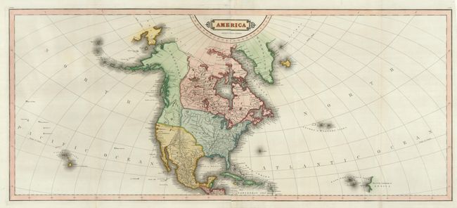
Subject: North America
Period: 1830 (circa)
Publication:
Color: Hand Color
Size:
35 x 15 inches
88.9 x 38.1 cm
The United States and Great Britain established in 1818 joint claim over the Oregon Territory - the region north of Spanish controlled Upper California up to the southern boundary of Russia's Alaska Territory at North latitude 54°40'. By the late 1830's this arrangement was beginning to fall apart.
In the 1840's the expansionist Democrats, including their 1844 presidential candidate, James Polk, claimed the entire region for the United States. Their expansionist desires were expressed by Polk's famous campaign slogan, "Fifty-four Forty or Fight!" The slogan also became a rally cry for Americans desiring to settle the territory. Following Polk's election, the dispute was resolved by the 1846 Treaty of Oregon, which struck a compromise that fixed the U.S./Canadian boundary at 49º North.
This large map of North America is printed on 4 joined sheets, as issued. The map extends into the Pacific Ocean to include Hawaii and into the Atlantic to includes the Azores and Cape Verde Islands. In North America the United States encroaches into present-day Canada in the Northwest. Alaska and much of western Canada is Independent Countries. The Rocky Mountains are shown as a mostly straight spine running north to south. The area of the Great Basin is mostly blank with one river traversing its interior. Very boldly engraved.
References:
Condition: A+
Flawless.